Collection: LEZ Maps
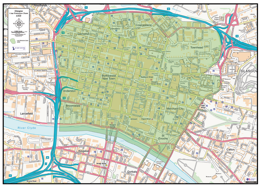
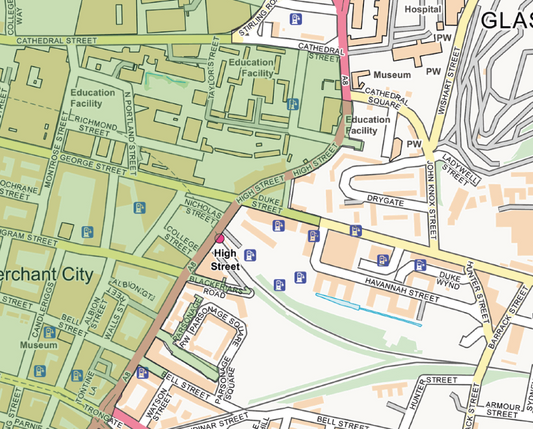
Our Low Emission Zone (LEZ) Maps use Ordnance Survey StreetView mapping to show the boundaries of Low Emission Zones in UK cities. Each map clearly overlays the LEZ area onto the street network, making it easy to identify exactly which streets fall within the zone.
These maps are useful for businesses operating vehicles in affected city centres, fleet managers planning delivery routes, and visitors who need to understand whether their vehicle is affected before entering a restricted area.
Maps are supplied as high-resolution PDF files and print at A2 size at actual scale. Available for instant download at £6.00 on order completion.