Collection: Postcode City Street Maps
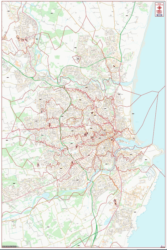
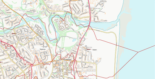
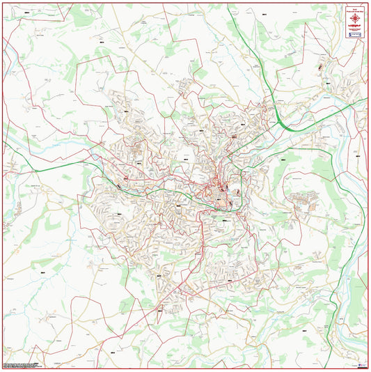
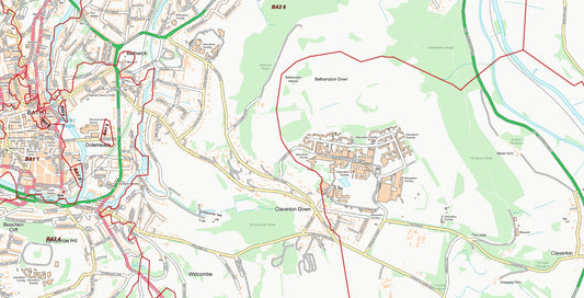
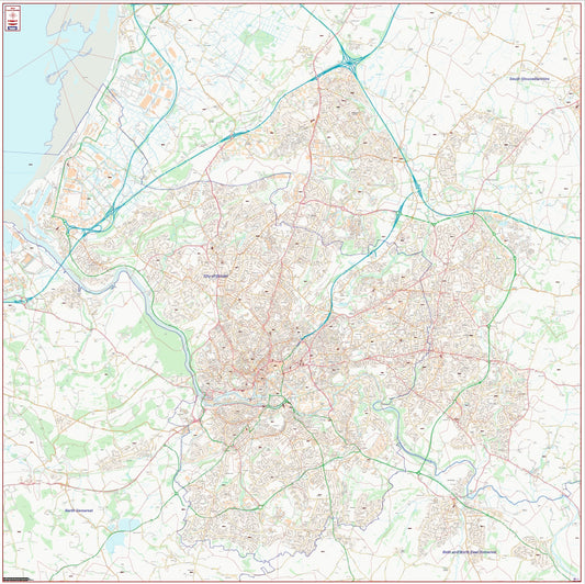
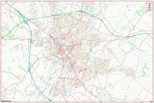
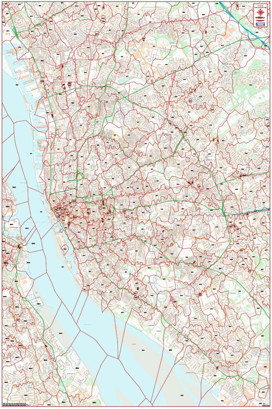
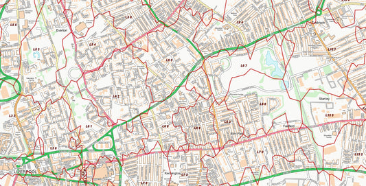
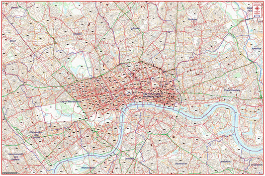
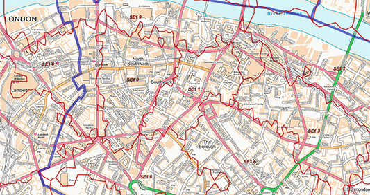
UK Maps' Postcode City Street Map series combines the precision of postcode sector boundaries with the detail of Ordnance Survey Street View mapping — giving you a city-level map that shows exactly where postcode sectors fall in relation to every street, road, and key landmark.
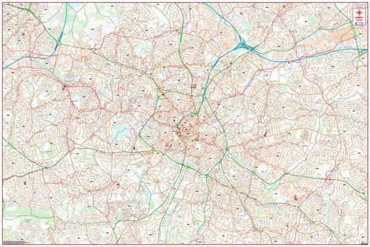
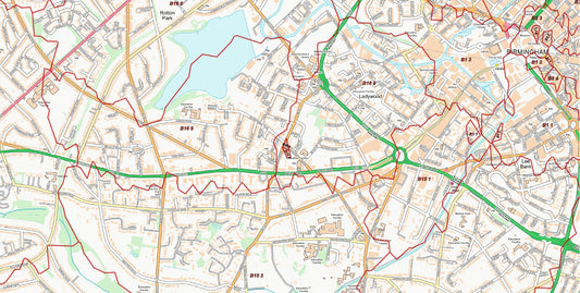
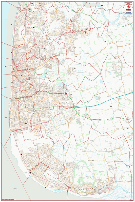
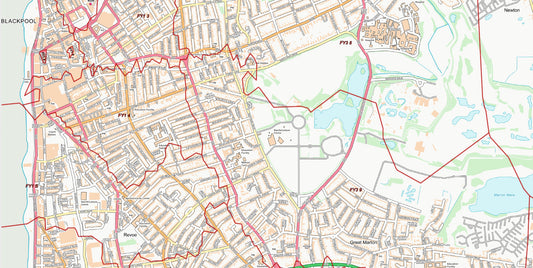
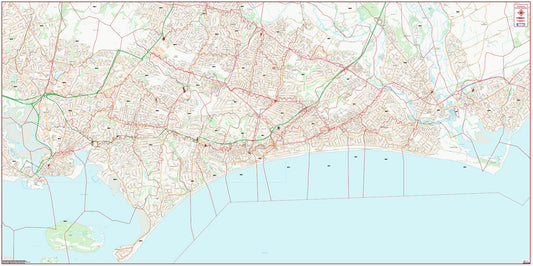
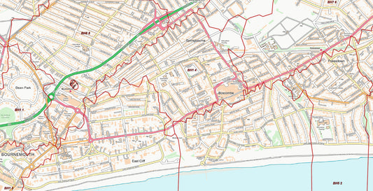
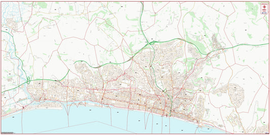
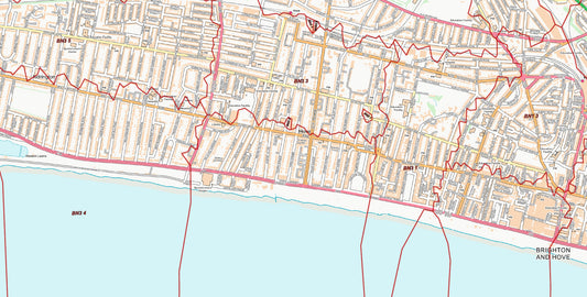
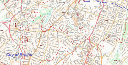
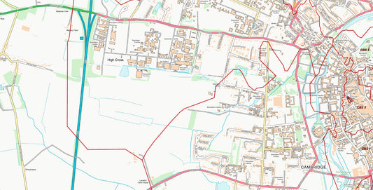
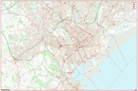
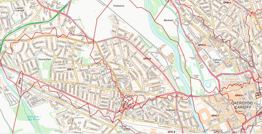
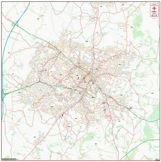
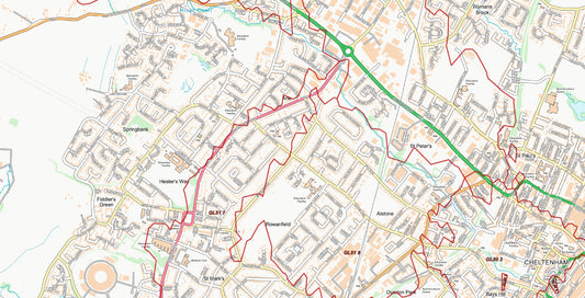
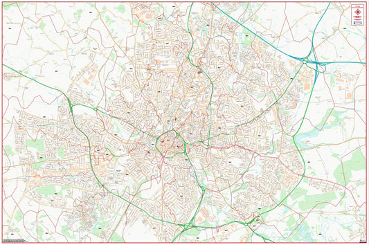
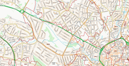
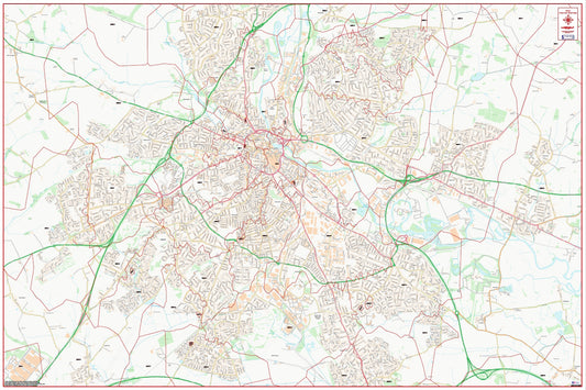
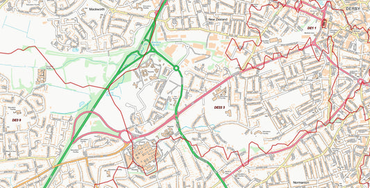
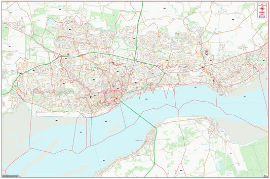
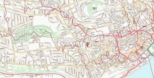
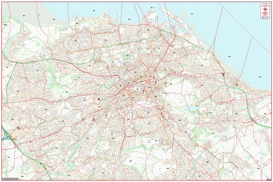
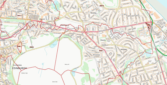
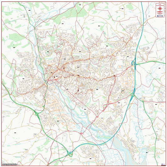
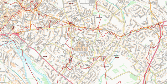
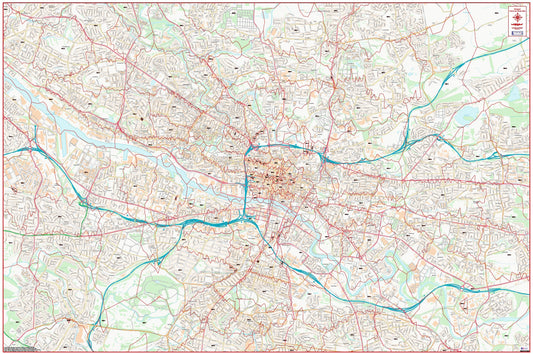
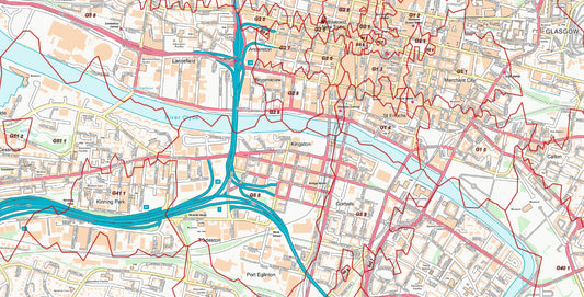
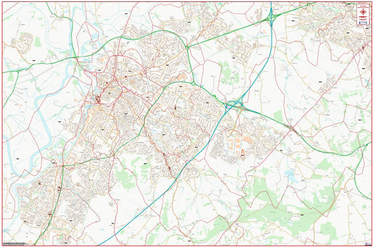
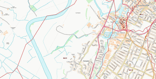
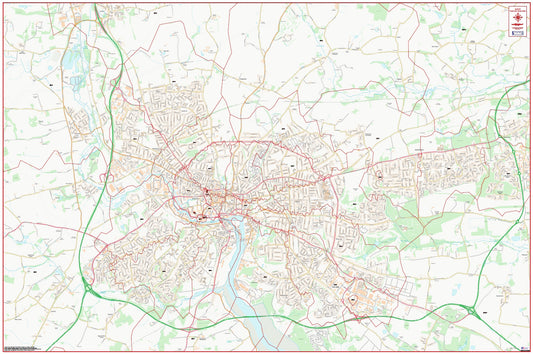
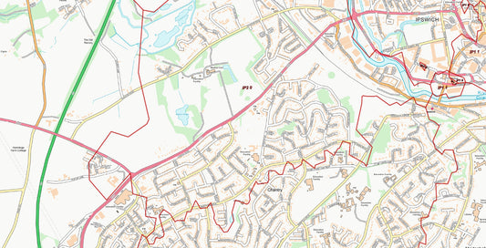
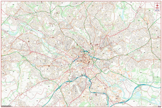
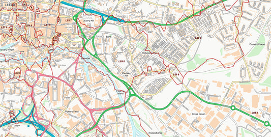
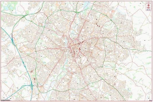
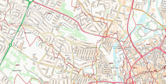
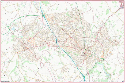
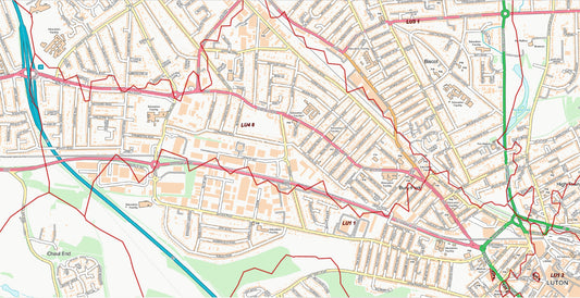
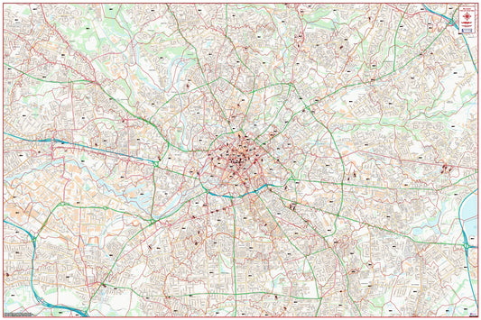
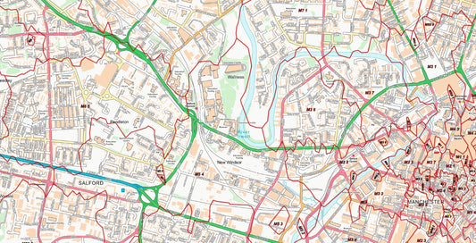
Unlike our standard postcode sector maps which use OS Road mapping, these city street maps are produced at 1:10,000 scale using OS StreetView data. At this scale, every road name is clearly legible, and public buildings such as hospitals, schools, libraries, and civic centres are all marked. Postcode sector boundaries are overlaid in a clear contrasting colour, making it straightforward to see precisely which streets and areas fall within each sector.
The series covers 50 of the UK's largest population centres, including Manchester, Birmingham, Leeds, Glasgow, Edinburgh, Bristol, Cardiff, and many more. Each map is supplied as a high-resolution PDF, ready for immediate download — ideal for printing for use in a presentation, briefing room, or operations centre.
These maps are particularly popular with delivery and logistics companies planning last-mile routing, field sales teams allocating representatives to specific postcode sectors, marketing agencies planning hyper-local direct mail or door-drop campaigns, contact centres defining local coverage zones, and estate agents mapping catchment areas.
All maps are produced by UK Maps, an authorised Ordnance Survey Licensed Partner with over 20 years' experience supplying mapping to businesses and organisations across the UK.