-
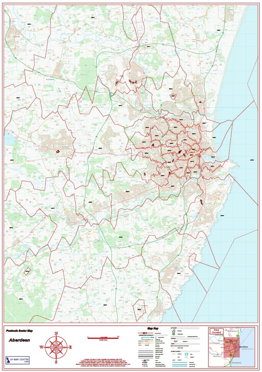
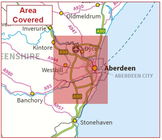
Aberdeen Postcode Sector Map | AB Postcode Boundaries PDF Download
Regular price £9.99Regular price -
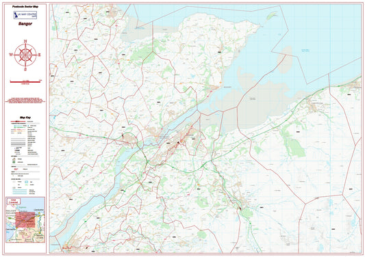
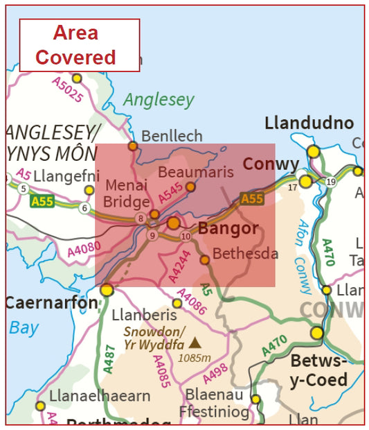
Bangor Postcode Sector Map | LL Postcode Boundaries PDF
Regular price £9.99Regular price -
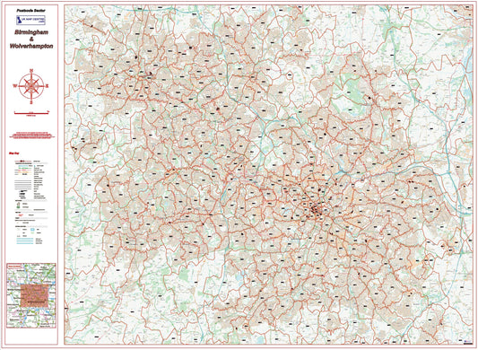
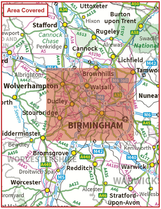
Birmingham Postcode Sector Map | Wolverhampton & B Postcode Boundaries PDF
Regular price £9.99Regular price -
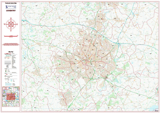
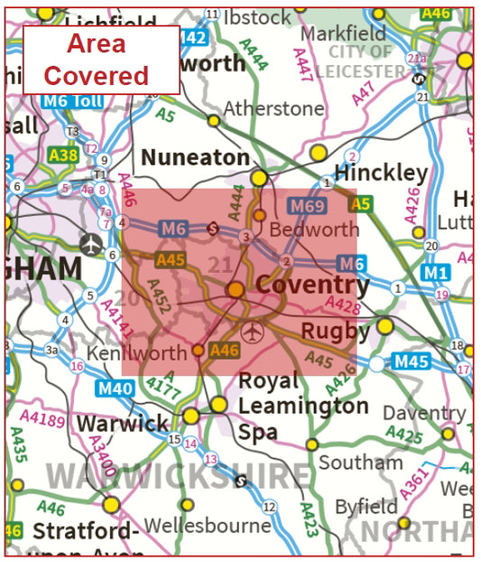
Coventry Postcode Sector Map | Warwickshire & CV Postcode Boundaries PDF
Regular price £9.99Regular price -
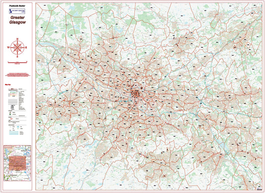
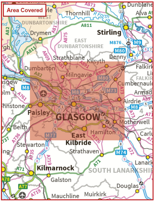
Greater Glasgow Postcode Sector Map | G Postcode Boundaries PDF Download
Regular price £9.99Regular price -
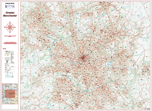
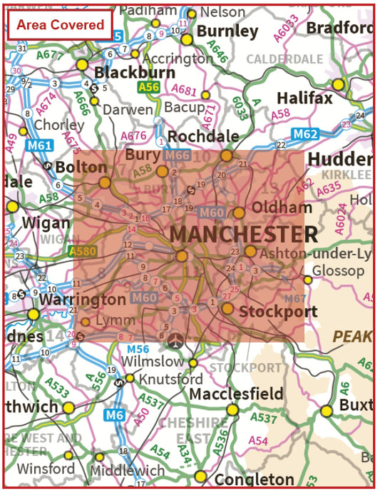
Greater Manchester Postcode Sector Map | M Postcode Boundaries PDF
Regular price £9.99Regular price -
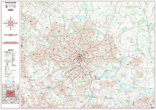
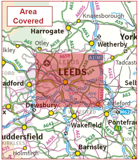
Leeds Postcode Sector Map | LS Postcode Boundaries PDF Download
Regular price £9.99Regular price -
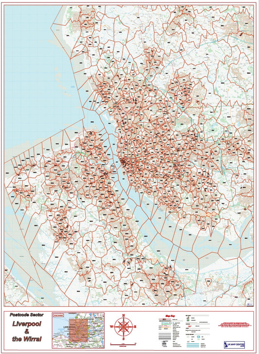
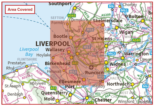
Liverpool Postcode Sector Map | Wirral & L Postcode Boundaries PDF
Regular price £9.99Regular price -
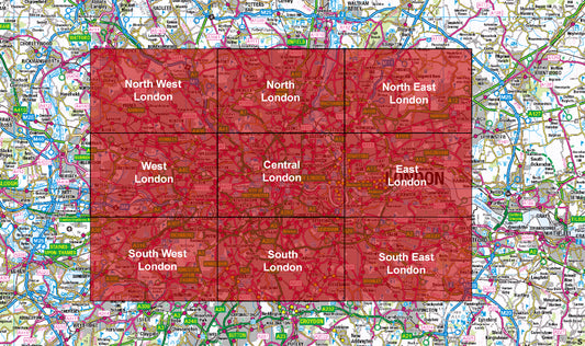
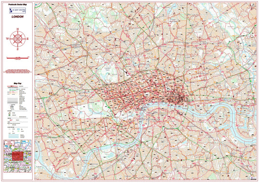
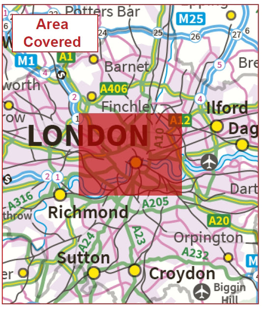
London Postcode City Street Maps | Full 9 Map Series PDF Download
Regular price £89.91Regular price -
London Postcode Sector Map | Central London Postcode Boundaries PDF
Regular price £9.99Regular price -
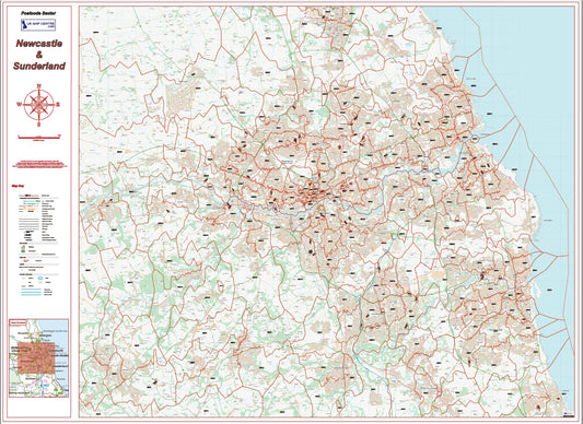
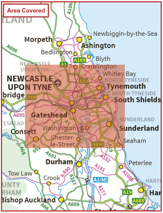
Newcastle Postcode Sector Map | Sunderland & NE Postcode Boundaries PDF
Regular price £9.99Regular price -
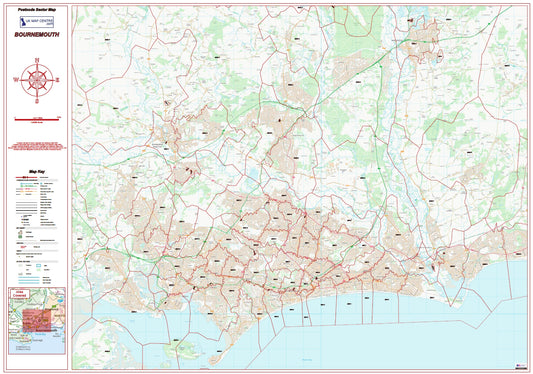
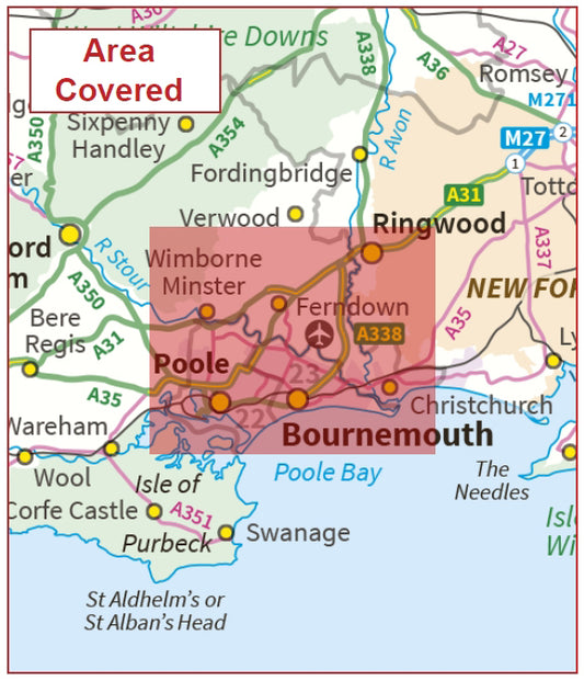
Postcode City Sector Map - Bournemouth - Digital Download
Regular price £9.99Regular price -
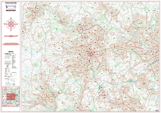
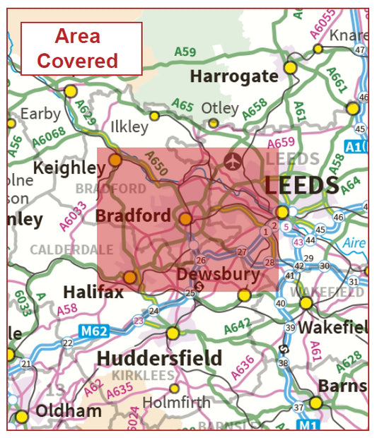
Postcode City Sector Map - Bradford - Digital Download
Regular price £9.99Regular price -
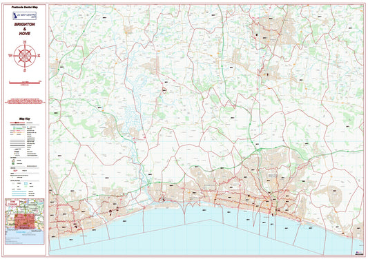
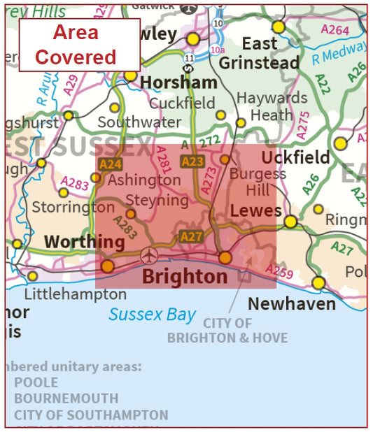
Postcode City Sector Map - Brighton & Hove - Digital Download
Regular price £9.99Regular price -
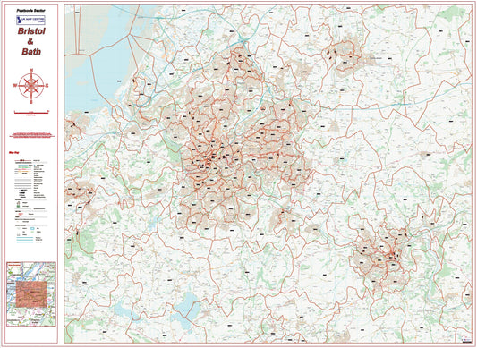
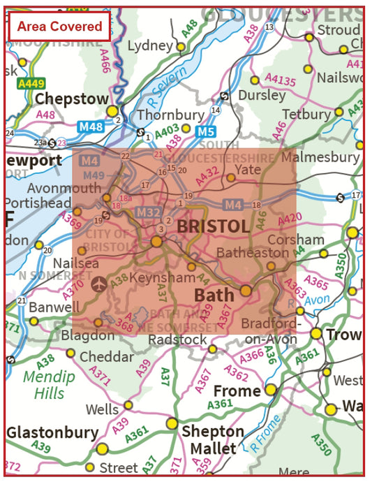
Postcode City Sector Map - Bristol & Bath - Digital Download
Regular price £9.99Regular price -
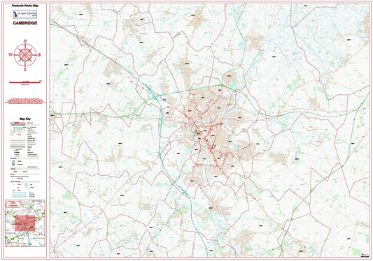
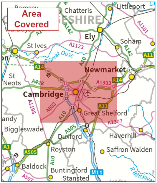
Postcode City Sector Map - Cambridge - Digital Download
Regular price £9.99Regular price -
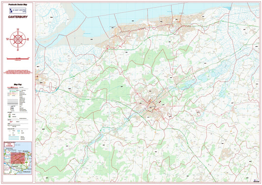
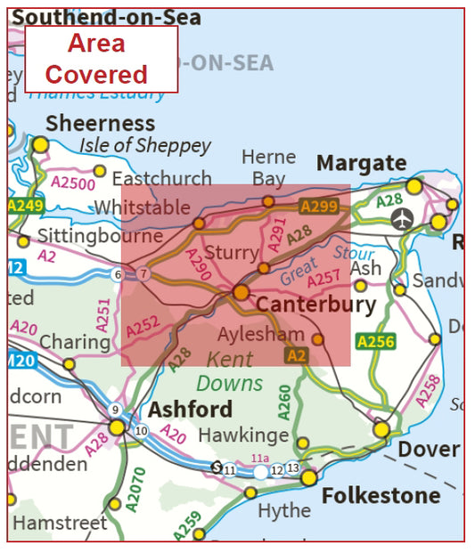
Postcode City Sector Map - Canterbury - Digital Download
Regular price £9.99Regular price -
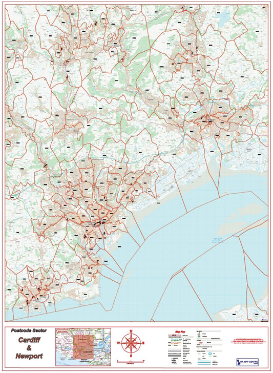
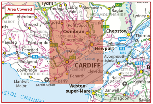
Postcode City Sector Map - Cardiff / Caerdydd and Newport / Casnewydd - Digital Download
Regular price £9.99Regular price -
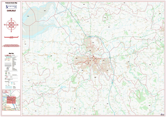
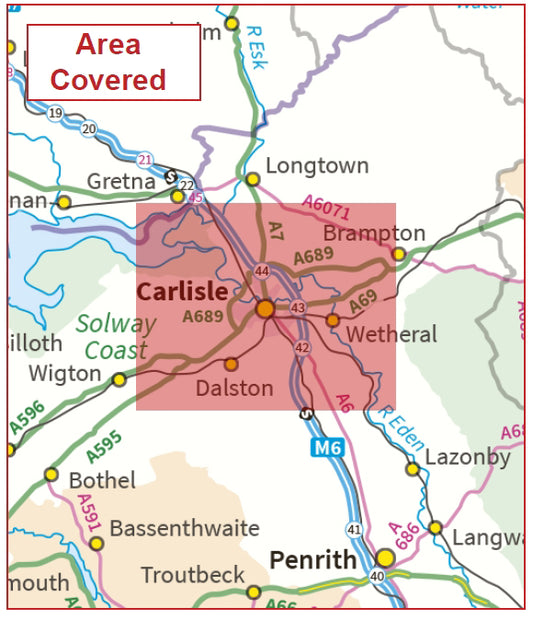
Postcode City Sector Map - Carlisle - Digital Download
Regular price £9.99Regular price -
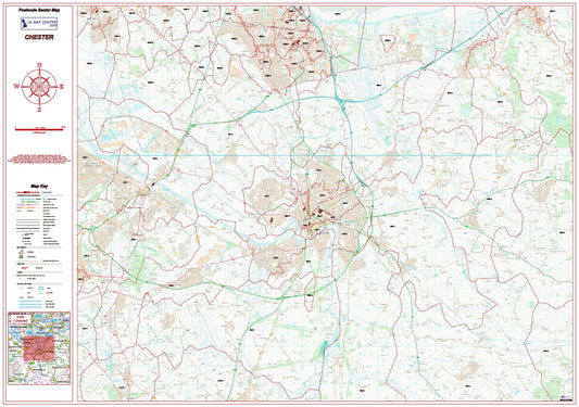
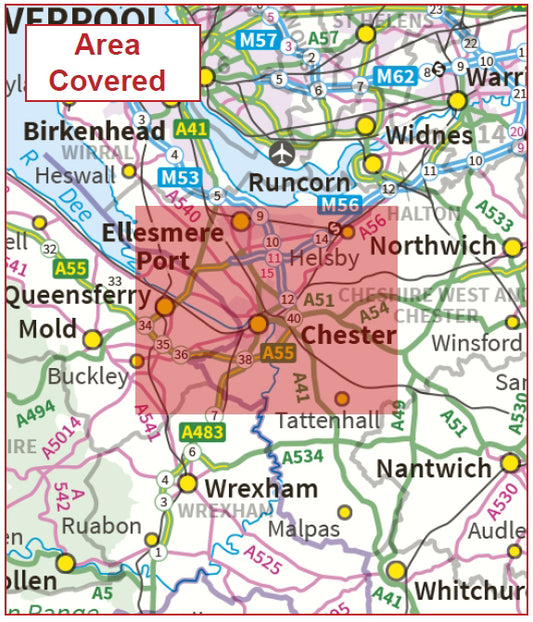
Postcode City Sector Map - Chester - Digital Download
Regular price £9.99Regular price -
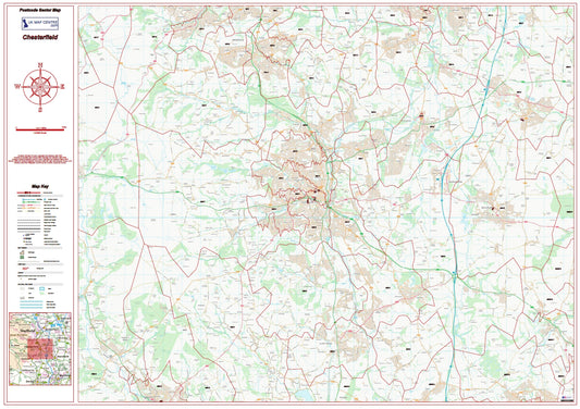
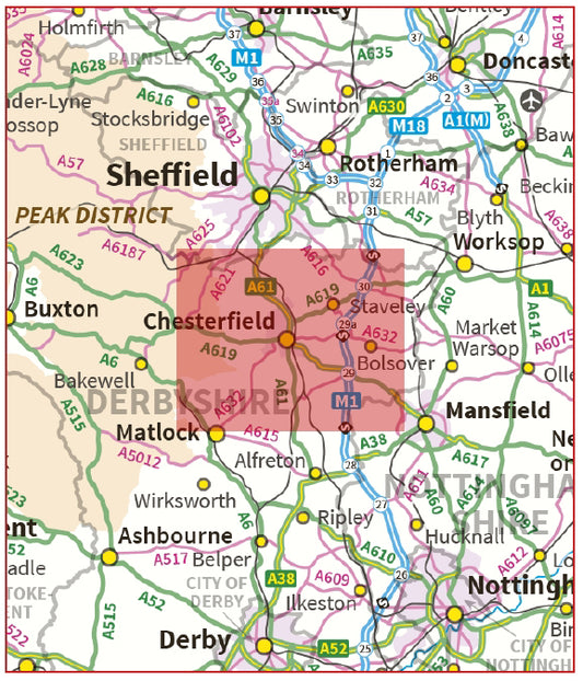
Postcode City Sector Map - Chesterfield - Digital Download
Regular price £9.99Regular price -
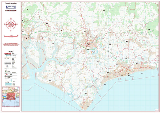
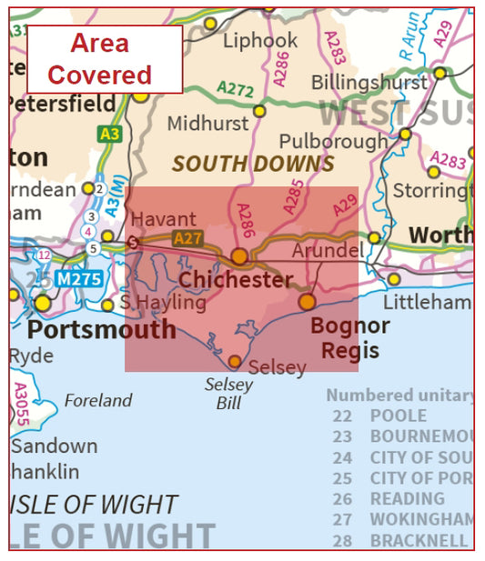
Postcode City Sector Map - Chichester - Digital Download
Regular price £9.99Regular price -
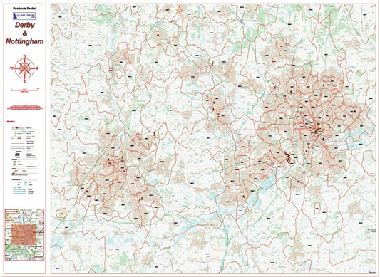
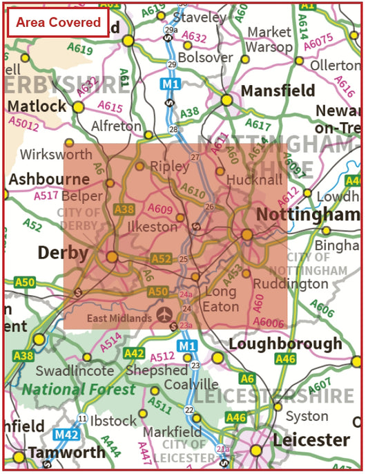
Postcode City Sector Map - Derby & Nottingham - Digital Download
Regular price £9.99Regular price -
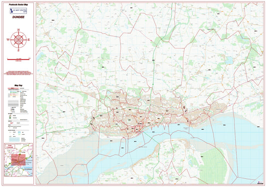
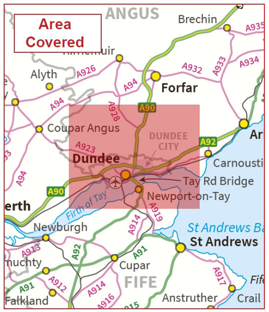
Postcode City Sector Map - Dundee - Digital Download
Regular price £9.99Regular price

Postcode Map Types

Caption
Which Postcode Map Do You Need?

Caption