ukmaps.co.uk
West Scotland Postcode District Map | Western Isles & Highlands PDF
West Scotland Postcode District Map | Western Isles & Highlands PDF
Couldn't load pickup availability
West Scotland Postcode District Map – Western Isles & Highland Coverage
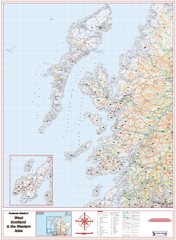
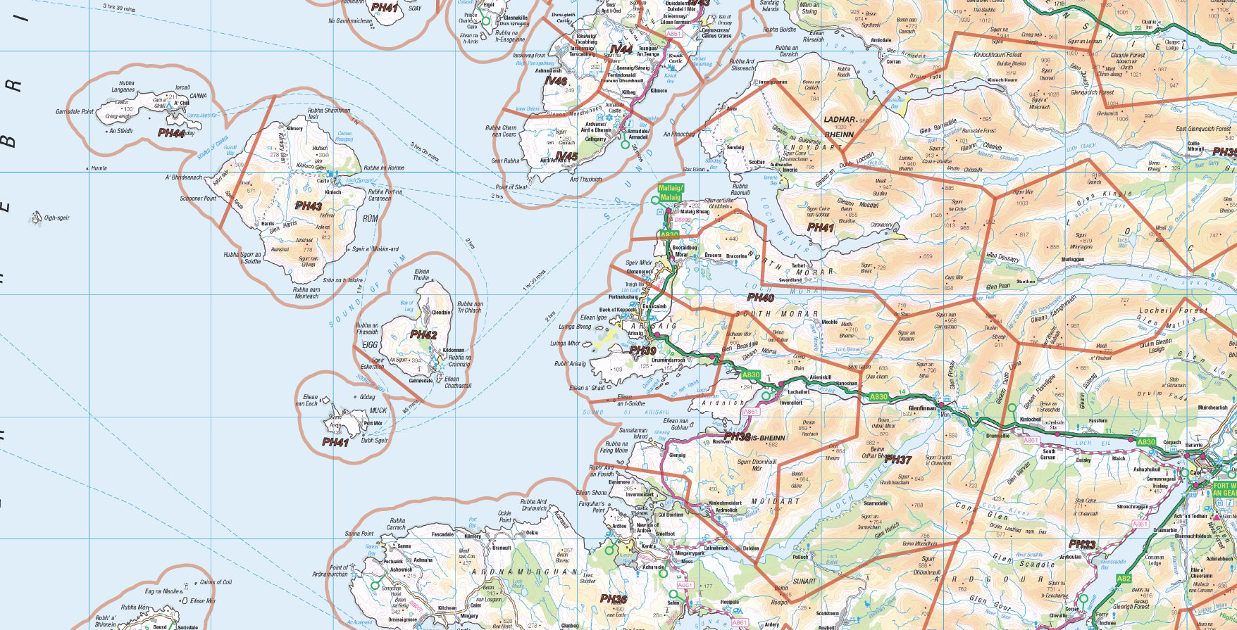
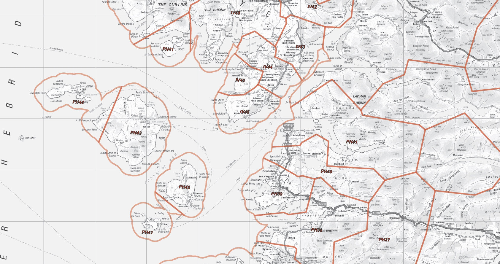
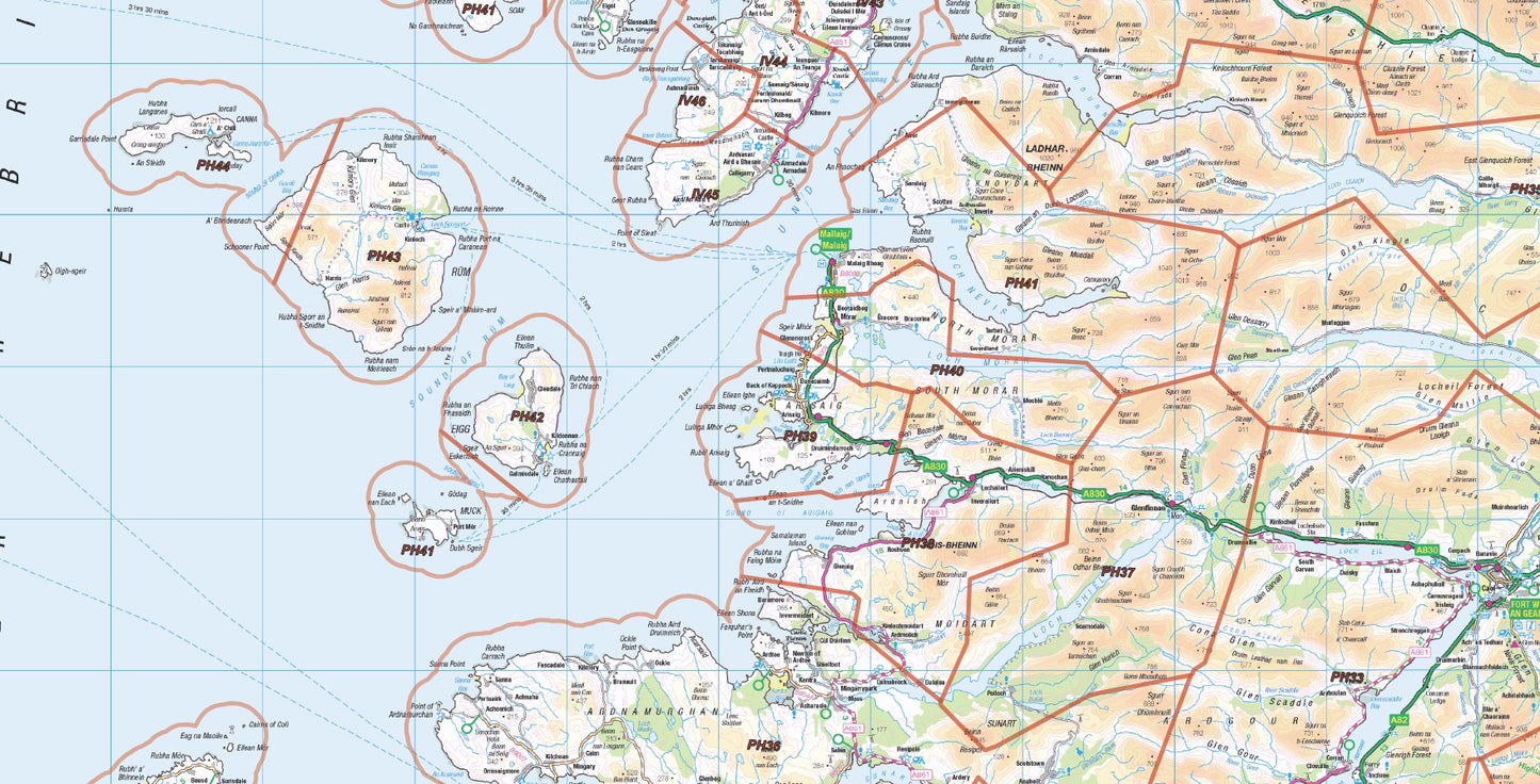
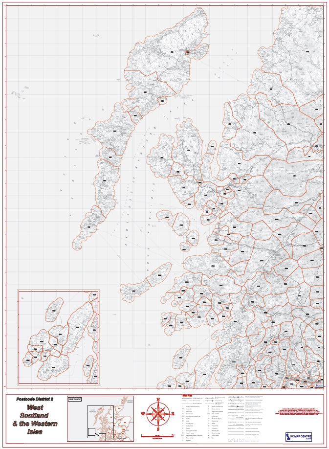
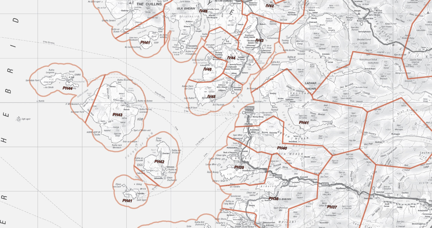
This West Scotland Postcode District Map provides detailed postcode coverage across the west coast of Scotland and the Western Isles, combining Ordnance Survey mapping with clearly defined district boundaries. It includes postcode districts such as PA (Argyll & Bute), PH (Highland Perthshire), IV (Highlands), and HS (Outer Hebrides).
Covering key locations including Fort William, Oban, Mallaig, and Kyle of Lochalsh, this high-resolution, print-ready PDF is ideal for logistics, planning, and regional analysis across mainland and island regions.
What is a Postcode District Map?
A postcode district map shows the second level of the UK postcode system, where each postcode area (e.g. PA or IV) is divided into numbered districts (e.g. PA34, IV1).
Compared to postcode area maps, district maps provide:
- more detailed geographic breakdown
- better targeting for logistics and delivery
- clearer regional analysis
This makes them particularly useful for complex coastal and island regions like West Scotland
Key Features & Specifications
- Coverage: West Scotland & Western Isles
- Includes postcode districts (e.g. PA34, PH33, IV40, HS1)
- Base mapping: Ordnance Survey
- Scale: 1:250,000
- Format: High-resolution PDF download
- Suitable for large-format printing (wall map use)
- Includes island insets (Islay, Jura, Colonsay and Hebrides)
What Does This Map Show?
This map provides a clear overview of:
- postcode districts across West Scotland
- coastal mainland regions and transport routes
- island groups including the Western Isles
- key towns such as Fort William, Oban, and Mallaig
- ferry-linked and remote communities
It allows users to understand postcode coverage across geographically complex and dispersed regions
Coverage Includes West Coast & Islands
This map includes postcode districts across:
- Argyll & Bute (PA postcode districts) – covering Oban, Mull, Islay, Jura and surrounding islands
- Scottish Highlands (IV postcode districts) – including west coast mainland areas
- Western Isles / Outer Hebrides (HS postcode districts) – island-wide coverage
- Perthshire Highlands (PH postcode districts) – inland and western Highland areas
Providing full coverage of Scotland’s west coast, island networks, and remote mainland regions
Common Uses
This postcode district map is widely used for:
- logistics and delivery planning across islands and remote areas
- defining sales territories across West Scotland
- postcode-based targeting for regional operations
- infrastructure and transport planning
Particularly useful for organisations working across coastal, ferry-linked, and island regions
Why Choose a West Scotland District Map?
This map offers:
- focused coverage of the west coast and islands
- better clarity than full UK or Scotland-wide maps
- more detail than postcode area maps
- practical use for complex geographic regions
Ideal for businesses operating across Western Scotland and island communities
Postcode Area vs District vs Sector Maps
- Area maps → broad regions (PA, IV, HS)
- District maps → detailed targeting (PA34, IV40, HS1)
- Sector maps → highly local targeting
District maps provide the best balance between detail and regional coverage
Digital Download & Print Use
- Instant download after purchase
- High-resolution PDF ready for printing
- Suitable for office walls, reports, and planning use
- Compatible with all standard PDF software
Postcodes Covered on this Map
Postcodes Covered on this Map
PA61, PA60, PA49, PA48, PA47, PA46, PA45, PA44, PA43, PA42, PA41, PA34, PA31, PA29, PA70, PA69, PA68, PA67, PH44, PH43, PH42, PA66, PH40, PH39, PH38, PH37, PH36, PH35, PH34, PH33, PA80, PA78, PA77, PA76, PA65, PA75, PA74, PA73, PA72, PA71, PA64, PA63, PA62, PA38, PA37, PA35, PA33, PA30, PA21, HS9, HS8, HS7, HS6, HS5, HS4, HS3, HS2, HS1, IV21, IV22, IV23, IV26, IV27, IV40, IV41, IV42, IV43, IV44, IV45, IV46, IV47, IV48, IV49, IV52, IV53, IV54, IV55, IV56, PH41, IV51, PH50, PH49, PH32, PH31, PH30, PH20, PH19, PH17, PH15, PA36, PA32, PA27, PA26, PA25, PA24, PA23, PA22, PA20, PA19, PA18, PA16, G84, G83, G82, G81, G63, G60, FK21, FK20, FK19, FK17, FK8, IV2, IV4, IV6, IV14, IV17, IV24, IV63, PA6, PA7, PA8, PA13, PA14, PA15
Share
About Digital Download Maps
About the Postcode District Map Series
The Postcode District Map Series of Maps splits the country into 8 maps, covering them using Ordnance Survey Road Mapping. Scaled at 1:250,000 this mapping clearly shows villages, towns and cities, the road and rail networks and is all overlayed with Postcode District data. These maps are ideal for businesses and organisations targeting large regions of the country.
Digital Downloads
Supplied as a High Quality PDF these maps are set up as 'Ready-To-Print' files which can
be printed at your local large-format print shop to scale. Alternatively this map can be used on any electronic device which has a PDF reader.
Brief Terms
Digital Download Products can not be returned once a purchase has been made. Please read the T&C's before making a purchase.
Please Note:
Once you place an order the file will be available to download for 14
days. If you intend to make multiple prints of the map you should
increase the quantity box accordingly
Custom Mapping
If you can't find a map to suit your needs we will happily quote you for a custom map.
Email your request to: custom@ukmapcentre.com or complete our online custom request form here > Custom Map Form
FAQ's
Digital Downloads
How will my files be supplied?
Map files are supplied in PDF format and are available to download immediately after payment has completed on the Thank You page through a displayed download link. If you miss this the download link is also emailed to you, so make sure you can access the email address entered at checkout.
Help! I've clicked the download link and I am getting an error or it's telling me the 'link has expired'. Can you help?
Of Course we can help! When you click the download link the file should start downloading via the browser. Usually you can see a download starting at the top right of the browser page, but it is easy to miss. Most PC's and laptops are set up to send downloaded files to the Download folder on the device so it's always worth checking there. If you can't find it get in touch and we'll help get you the file.
Printing the Map Files
Do you supply Printed Maps?
No, we only supply OS mapping in digital format - most often in PDF format. This is easy to open and use on most electronic devices and is also very easy to print from.
Can I have my map files printed?
We don't offer a printing service, but you can take your map file to a local printing company, or send it by email to a national company to have the file printed to your specification.
More Printing Queries
Can I change the print size when I get the map file printed?
We do not recommend changing the print size. All the map files have been created to be printed at Actual Size. This keeps it easy when it comes to printing, just print it at the size it's supposed to be. If the file is scaled then it could become blurry, blocky or otherwise illegible.
Licencing
Can I print a map from the file I've bought?
Yes, typically you are licenced to print one copy of the map from the file purchase. If you want more prints please increase the number of items you want to purchase in the Quantity box.
Can I use the map or parts of it online?
No, you can not publish the file online without the correct licence. This can be obtained from OS, please contact us for more information.
Subscribe to our emails
Be the first to know about new collections and exclusive offers.