
ukmaps.co.uk
OS VectorMap Local (VML) Tiles by UK County & Shire | 1:10,000 Vector Mapping Data
OS VectorMap Local (VML) Tiles by UK County & Shire | 1:10,000 Vector Mapping Data
OS VectorMap Local (VML) tiles provide highly detailed, customisable vector mapping data for Great Britain at a 1:10,000 scale. This product supplies OS VML data pre-packaged by UK counties and historic shires, allowing you to obtain complete regional coverage without selecting individual tiles.
Unlike raster maps, vector data enables full control over styling, editing, and analysis. County-based datasets simplify workflows by delivering ready-to-use mapping aligned to administrative areas, making them ideal for GIS, planning, and spatial analysis projects.
What Makes These Tiles Different?
What Makes These Tiles Different?
Standard OS VectorMap Local data is supplied as individual grid tiles. This product groups tiles into county and shire-based datasets, allowing you to:
- download complete county coverage in one order
- avoid managing multiple 5km vector tiles
- ensure seamless mapping across administrative boundaries
- streamline GIS workflows for regional projects
This makes it particularly useful for multi-site and large-area mapping applications.
What are OS Raster Tiles?
What are OS Raster Tiles?
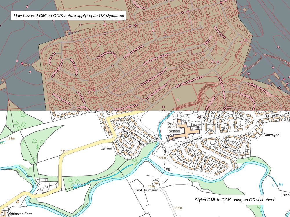
OS VectorMap Local is a detailed vector mapping dataset that represents real-world features as points, lines, and polygons, rather than static images.
At a nominal scale of 1:10,000, it provides a clear and flexible representation of:
buildings and property outlines
roads, railways, and transport networks
rivers and water features
land use and vegetation
administrative boundaries and urban extents
Because it is vector-based, the data can be styled, edited, and analysed within GIS software to suit different applications.
Key Features & Specifications
Key Features & Specifications
- Data type: Vector mapping (points, lines, polygons)
- Scale: 1:10,000
- Tile size: 5km × 5km
- Coverage: Great Britain
- Formats: GML, Shapefile, GeoPackage (GIS-ready)
- Fully georeferenced to the National Grid
- Customisable styling and symbology
- Supplied as grouped county or shire datasets
OS VectorMap Local is derived from authoritative Ordnance Survey data, ensuring accurate and reliable representation of real-world features.
Coverage by UK Counties & Shires
Coverage by UK Counties & Shires
Vector tiles are grouped into county and historic shire areas, enabling efficient access to mapping data for:
- English counties (e.g. Yorkshire, Kent, Lancashire)
- Scottish historic counties
- Welsh counties
This structure is ideal for projects requiring complete regional mapping coverage, including:
- planning and development across districts
- land and property analysis
- infrastructure and utility mapping
- environmental and spatial studies
Common Uses
Common Uses
OS VectorMap Local data is widely used for:
- GIS mapping and spatial analysis
- planning and site evaluation
- web mapping and application development
- land and property management
- infrastructure and network mapping
It is particularly valuable where users need editable and customisable mapping data, rather than fixed raster imagery.
Why Choose County-Based Tile Bundles?
Why Choose County-Based Tile Bundles?
Combining OS VectorMap Local with county-based delivery provides:
- faster access to large datasets
- simplified purchasing and data management
- reduced setup time in GIS systems
- consistent mapping across project areas
This is especially useful for professionals working across multiple locations or entire regions.
Delivery & Licensing
Delivery & Licensing
- Fast digital delivery
- Licensed Ordnance Survey data
- Supplied in industry-standard GIS formats
Suitable for GIS, CAD, and web mapping applications
FAQs
FAQs
What is OS VectorMap Local used for?
It is used for GIS mapping, planning, spatial analysis, and web mapping applications.
What format is the data supplied in?
Typically GML, Shapefile, or GeoPackage formats compatible with GIS software.
What is the difference between vector and raster tiles?
Vector tiles contain editable geographic data, while raster tiles are fixed images.
What area does each tile cover?
Each tile covers 5km × 5km.
Are these standard OS VML tiles?
Yes, but supplied as grouped datasets covering full counties or shires.
Couldn't load pickup availability
Need a Smaller Area? Check out our individual Pages for making custom areas:
Share
About Digital Download Maps
About the County OS Tiles Series
We've created a one-stop place to get OS Map Tiles by County - ideal for councils, public bodies and large companies looking to get quick access to OS data for the Counties across the UK
Terminals and Usage
The Terminals selector is a required field in which you indicate on how many devices or terminals the data will be used. This information is supplied to OS for copyright compliance.
OS Tile data purchased from the UK Map Centre can only be used for Internal Business Use only. This data can not be re-soled or used for commercial gain. Please see our Terms and Conditions here
Brief Terms - OS Tiles
Digital Download Products can not be returned once a purchase has been made. Please read the T&C's before making a purchase.
Please Note:
Once you place an order the file will be available to download for 14
days. If you have a any queries about licencing or terminals please do not hesitate to get in touch.
Subscribe to our emails
Be the first to know about new collections and exclusive offers.