

ukmaps.co.uk
Snowdon / Yr Wyddfa - OS Walking Map Download
Snowdon / Yr Wyddfa - OS Walking Map Download
Couldn't load pickup availability
Snowdon / Yr Wyddfa OS Walking Map
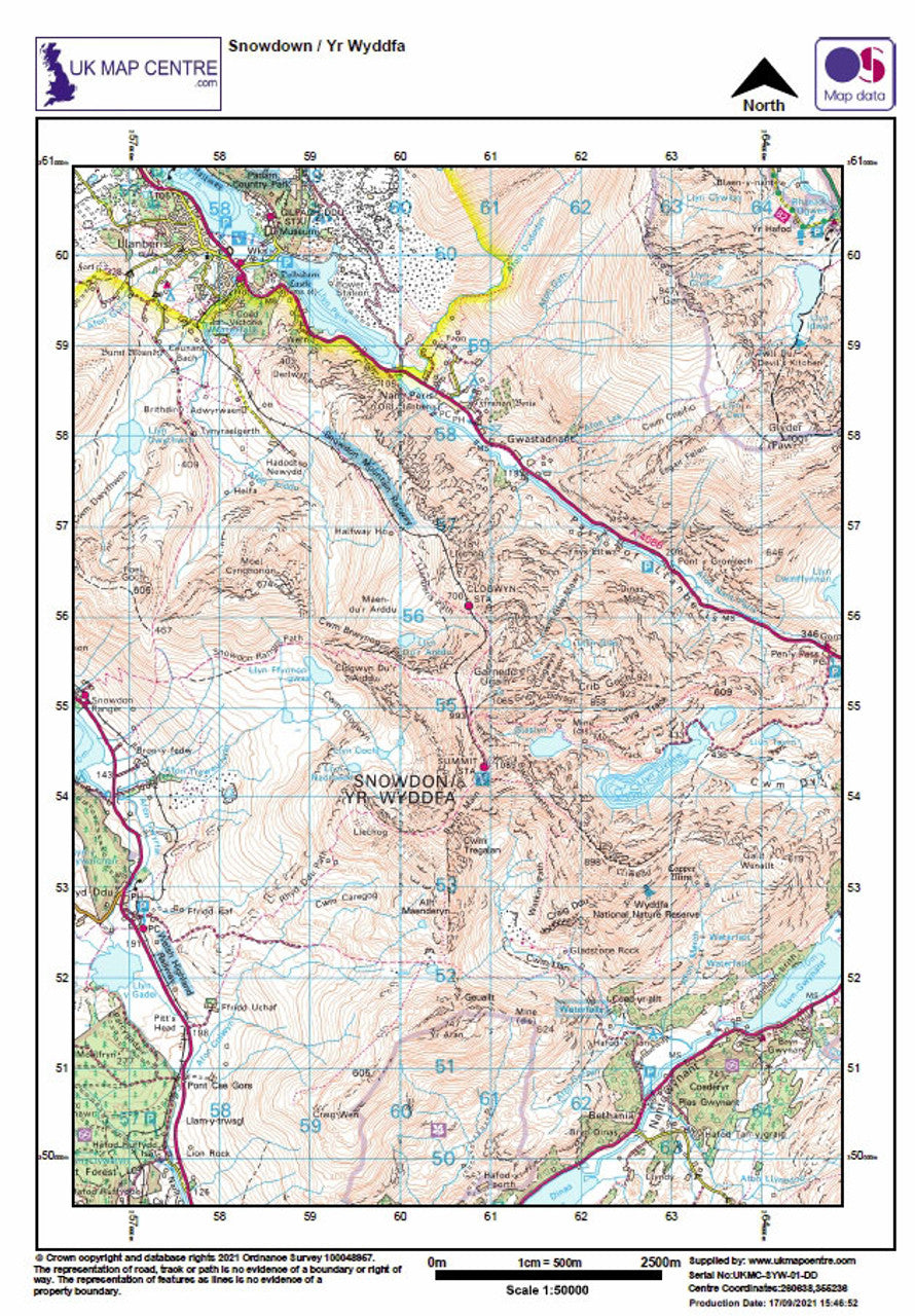
This digital walking map covers Snowdon (Yr Wyddfa in Welsh) — at 1,085 metres, the highest mountain in Wales and the highest peak in England and Wales. Located in Snowdonia National Park (Eryri), Snowdon is one of the most visited mountains in the world, with an estimated 600,000 people making the ascent each year by a variety of well-established routes.
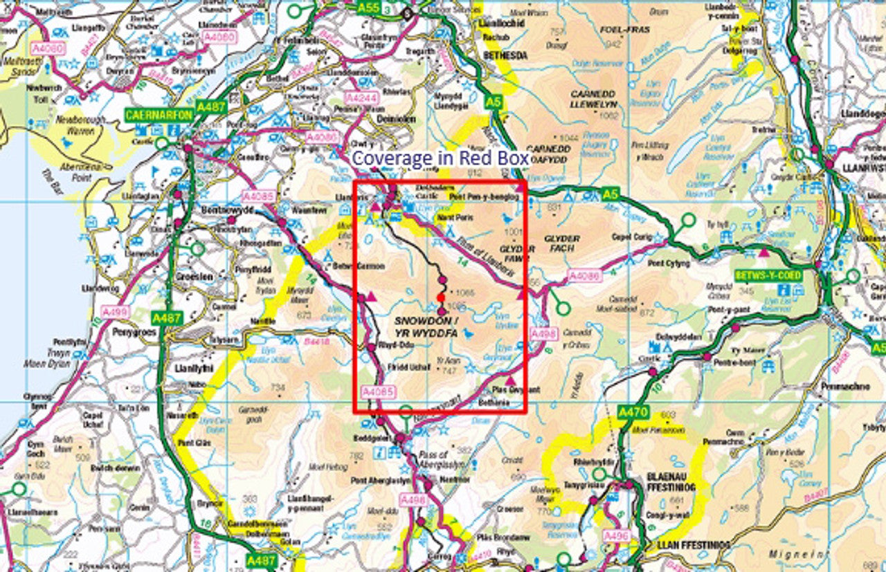
What the Map Covers
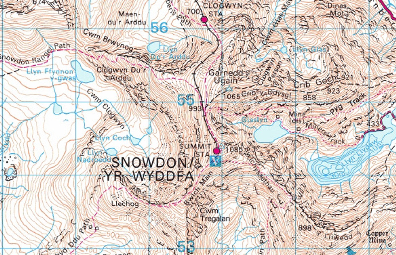
The map covers the Snowdon massif and its surrounding landscape, showing the mountain and its principal approach routes in overview. Key features shown include the Llanberis Path from the north-west, the Miners' Track and Pyg Track from the Pen-y-Pass car park to the east, the Watkin Path from the south, and the Snowdon Ranger Path from the west. The Snowdon Mountain Railway line from Llanberis is also shown, along with the summit station (Hafod Eryri) as a key orientation point.
About the Walk
Snowdon has six main walking routes to the summit, ranging from the well-graded Llanberis Path (the longest but least steep) to the more dramatic Pyg Track and the scrambling challenge of Crib Goch on the full Horseshoe route. The mountain receives high footfall year-round, but paths can be icy in winter and early spring when ice axe and crampons are often essential. The summit café (Hafod Eryri) is open in season and provides welcome shelter at the top.
Map Details
Produced from up-to-date Ordnance Survey 1:50,000 scale mapping, updated every three months. Supplied as a high-resolution PDF for immediate download — print at home at A4 size or view on any device that supports PDF files. When printing, always set scaling to 100% (Actual Size) to ensure the map prints to the correct scale.
Please note: Once you place an order the file will be available to download for 14 days. If you intend to make multiple prints, increase the quantity accordingly.
Share

FAQ's
Digital Download: Short T&C's
Digital Download Products can not be returned once a purchase has been made. Please read the T&C's before making a purchase. Please Note: Once you place an order the file will be available to download for 14 days. If you intend to make multiple prints of the map you should increase the quantity box accordingly.
Digital Downloads
How will my files be supplied?
Map files are supplied in PDF format and are available to download immediately after payment has completed on the Thank You page through a displayed download link. If you miss this the download link is also emailed to you, so make sure you can access the email address entered at checkout.
Help! I've clicked the download link and I am getting an error or it's telling me the 'link has expired'. Can you help?
Of Course we can help! When you click the download link the file should start downloading via the browser. Usually you can see a download starting at the top right of the browser page, but it is easy to miss. Most PC's and laptops are set up to send downloaded files to the Download folder on the device so it's always worth checking there. If you can't find it get in touch and we'll help get you the file.
Printing the Map Files
Do you supply Printed Maps?
No, we only supply OS mapping in digital format - most often in PDF format. This is easy to open and use on most electronic devices and is also very easy to print from.
Can I have my map files printed?
We don't offer a printing service, but you can take your map file to a local printing company, or send it by email to a national company to have the file printed to your specification.
More Printing Queries
Can I change the print size when I get the map file printed?
We do not recommend changing the print size. All the map files have been created to be printed at Actual Size. This keeps it easy when it comes to printing, just print it at the size it's supposed to be. If the file is scaled then it could become blurry, blocky or otherwise illegible.
Licencing
Can I print a map from the file I've bought?
Yes, typically you are licenced to print one copy of the map from the file purchase. If you want more prints please increase the number of items you want to purchase in the Quantity box.
Can I use the map or parts of it online?
No, you can not publish the file online without the correct licence. This can be obtained from OS, please contact us for more information.
Custom Maps
If you can't find a map to suit your needs we will happily quote you for a custom map.
Email your request to: custom@ukmapcentre.com or complete our online custom request form via this link > Custom Map Form
Subscribe to our emails
Be the first to know about new collections and exclusive offers.