
ukmaps.co.uk
Travel Map 5 - Wales - Digital Download
Travel Map 5 - Wales - Digital Download
Couldn't load pickup availability
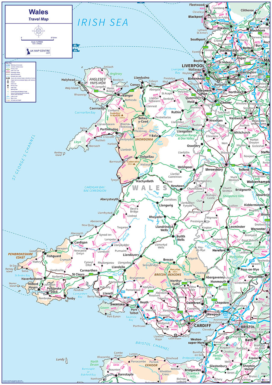
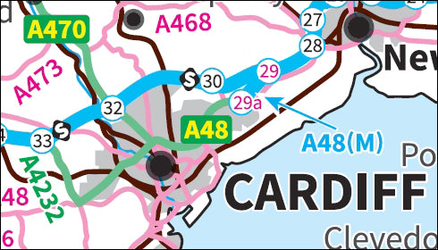
Travel Map 5 shows Wales at 1:275,000 scale, plotting all road, rail, and ferry communication links across the principality and its connections to nearby islands and Ireland. The finer scale gives greater network detail than the broader England and Wales or Full UK maps.
What the Map Shows
- All major roads across Wales, including the A55 and M4
- The Welsh rail network: main lines, valleys lines, and rural connections
- Ferry routes from Holyhead, Pembroke, and Fishguard to Ireland
- Connections to Anglesey and other nearby islands
- A key identifying all communication link symbols
Who It Is For
Suitable for businesses and organisations operating across Wales, logistics teams managing Welsh routes, and offices that need a single clear transport overview of the principality for display or planning. Also used in educational and public sector contexts.
Map Details
- Scale: 1:275,000
- Print size: 841mm x 1189mm (A0)
- Format: 300 dpi PDF, instant digital download
- Produced under Ordnance Survey licence number AC0000848283
Share

FAQ's
Digital Download: Short T&C's
Digital Download Products can not be returned once a purchase has been made. Please read the T&C's before making a purchase. Please Note: Once you place an order the file will be available to download for 14 days. If you intend to make multiple prints of the map you should increase the quantity box accordingly.
Digital Downloads
How will my files be supplied?
Map files are supplied in PDF format and are available to download immediately after payment has completed on the Thank You page through a displayed download link. If you miss this the download link is also emailed to you, so make sure you can access the email address entered at checkout.
Help! I've clicked the download link and I am getting an error or it's telling me the 'link has expired'. Can you help?
Of Course we can help! When you click the download link the file should start downloading via the browser. Usually you can see a download starting at the top right of the browser page, but it is easy to miss. Most PC's and laptops are set up to send downloaded files to the Download folder on the device so it's always worth checking there. If you can't find it get in touch and we'll help get you the file.
Printing the Map Files
Do you supply Printed Maps?
No, we only supply OS mapping in digital format - most often in PDF format. This is easy to open and use on most electronic devices and is also very easy to print from.
Can I have my map files printed?
We don't offer a printing service, but you can take your map file to a local printing company, or send it by email to a national company to have the file printed to your specification.
More Printing Queries
Can I change the print size when I get the map file printed?
We do not recommend changing the print size. All the map files have been created to be printed at Actual Size. This keeps it easy when it comes to printing, just print it at the size it's supposed to be. If the file is scaled then it could become blurry, blocky or otherwise illegible.
Licencing
Can I print a map from the file I've bought?
Yes, typically you are licenced to print one copy of the map from the file purchase. If you want more prints please increase the number of items you want to purchase in the Quantity box.
Can I use the map or parts of it online?
No, you can not publish the file online without the correct licence. This can be obtained from OS, please contact us for more information.
Custom Maps
If you can't find a map to suit your needs we will happily quote you for a custom map.
Email your request to: custom@ukmapcentre.com or complete our online custom request form via this link > Custom Map Form
Subscribe to our emails
Be the first to know about new collections and exclusive offers.